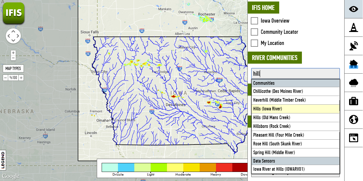
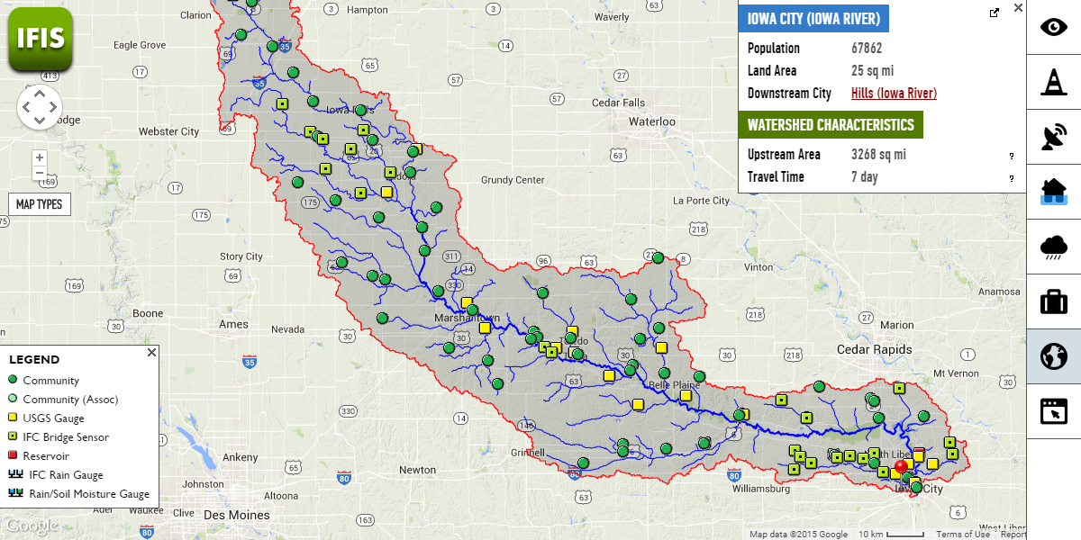
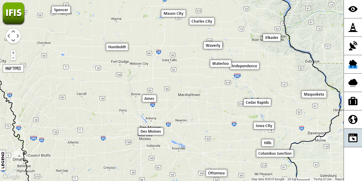
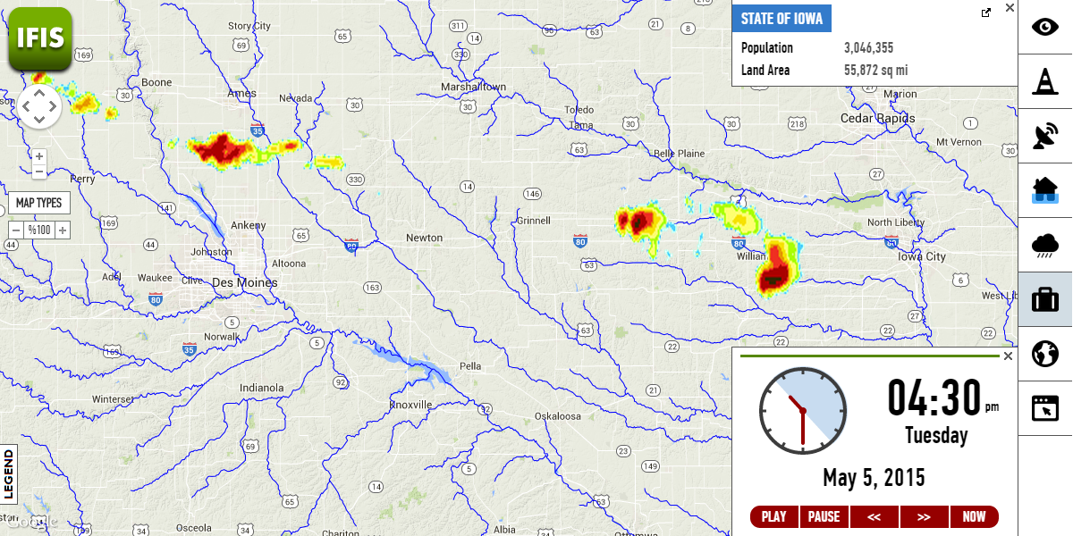
Community-based flood conditions, data resources, and upstream watershed characteristics
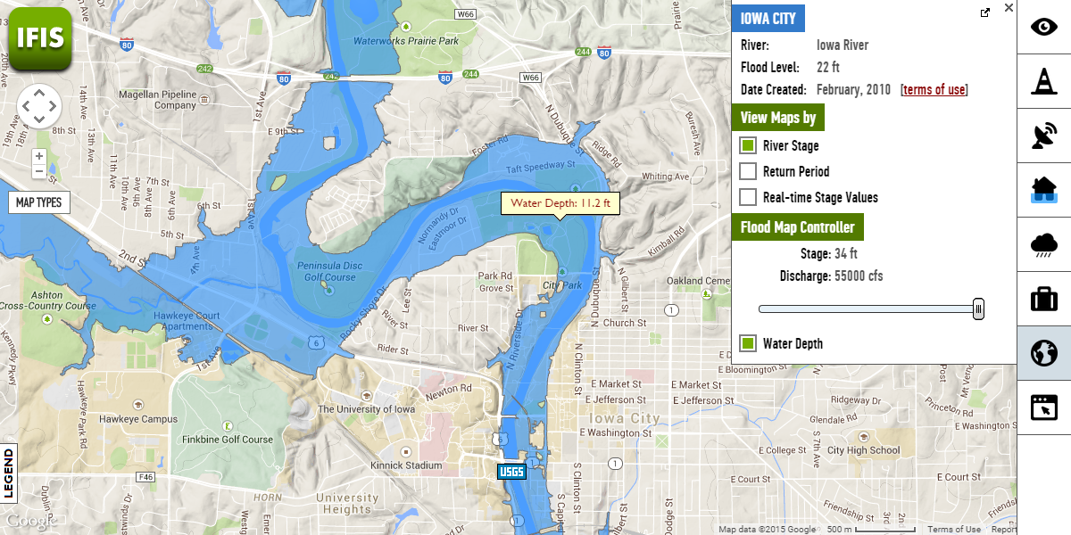
Inundation maps provide information on the extent and depth of flood waters
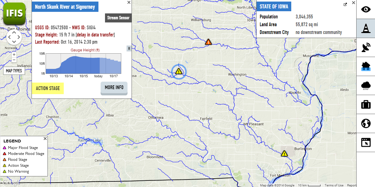
Real-time water levels and stage heights with flood alert levels, and flood forecast
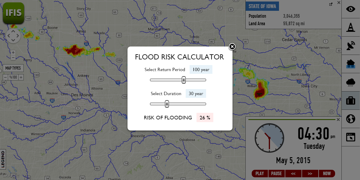
Calculate risk of flooding based on annual chance and duration.

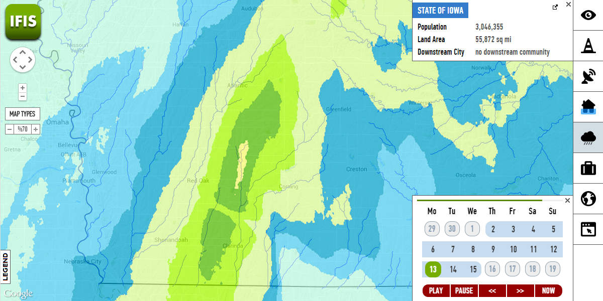
Real-time rainfall maps displaying current conditions, and past rainfall accumulation. Rainfall products are supported by National Science Foundation (NSF) under grants 0427422 (ATM) and 0839576 (GEO).
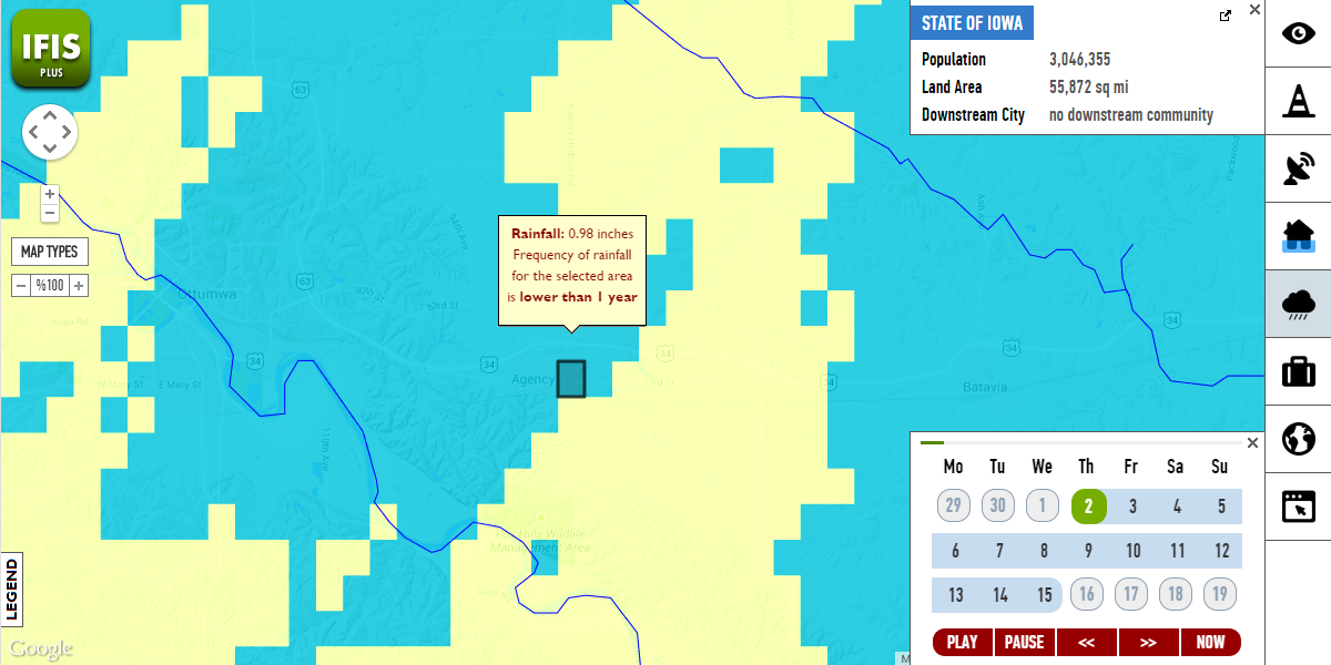
Compare daily rainfall accumulation with frequency in real-time (utilizing WebGL)
Visualizations of water levels and stream gauge readings with 3D/2D interactive animations
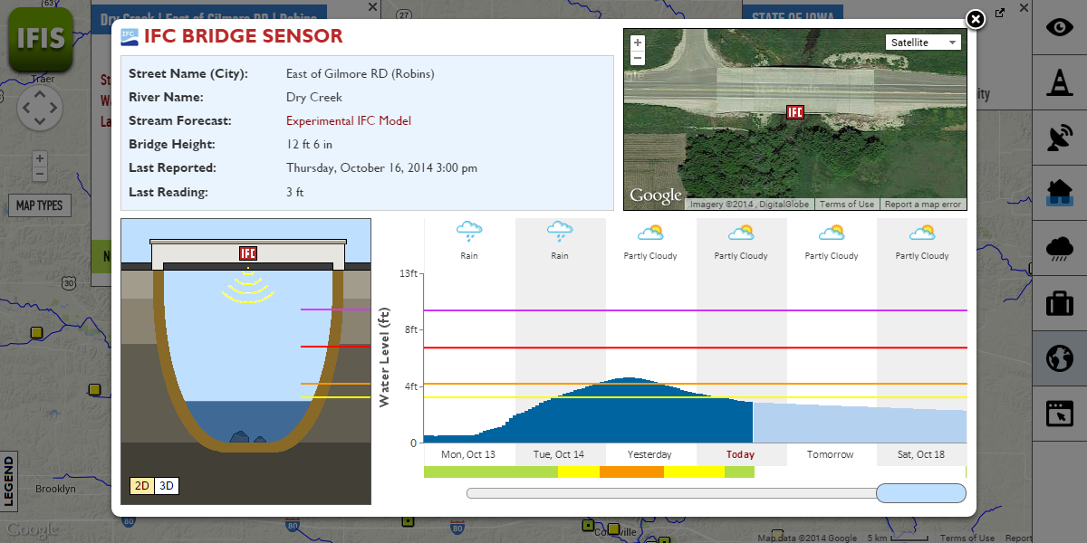
Data from IFC's bridge sensors, rain gauges, and data sources with real-time and historical information
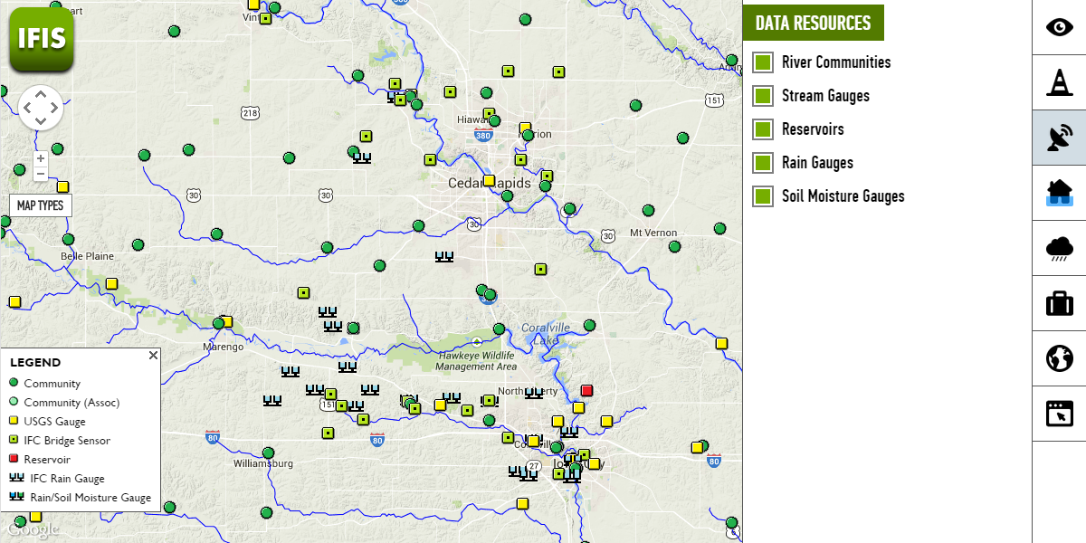
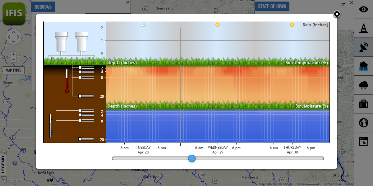
Data from rain and soil moisture gauges are visualized in a custom interface.
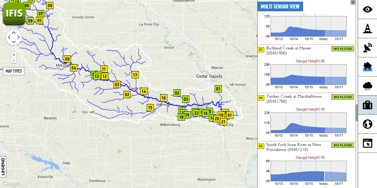
Visualization of data from multiple IFC bridge sensors and USGS gauges in a single view along a river
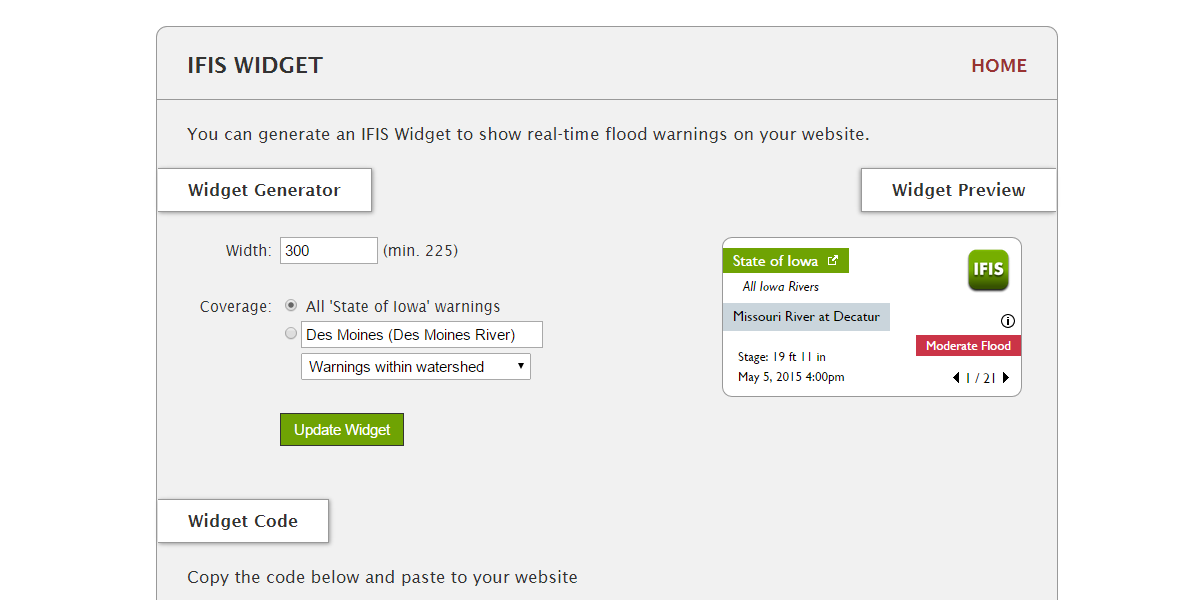
Integrate flood alerts to your website using IFIS Widget.
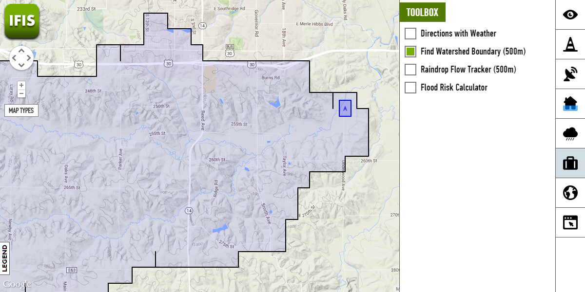
See how rainfall moves in the river network. Click anywhere on the map and see rain draining in the river network.
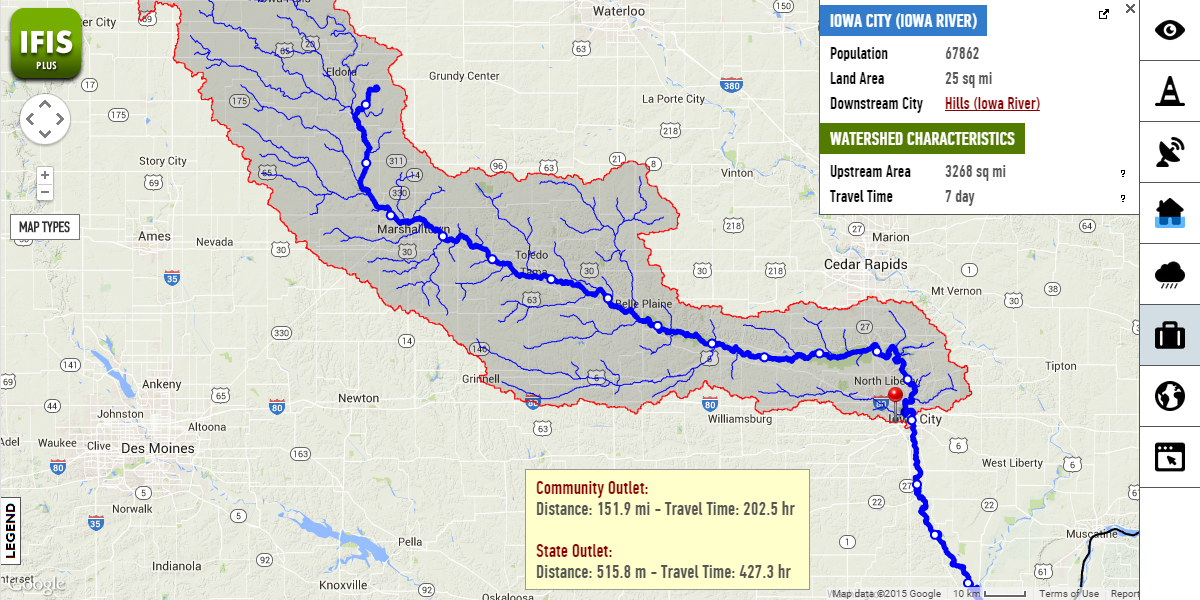
Click anywhere on the map and generate watershed instantly in Iowa.
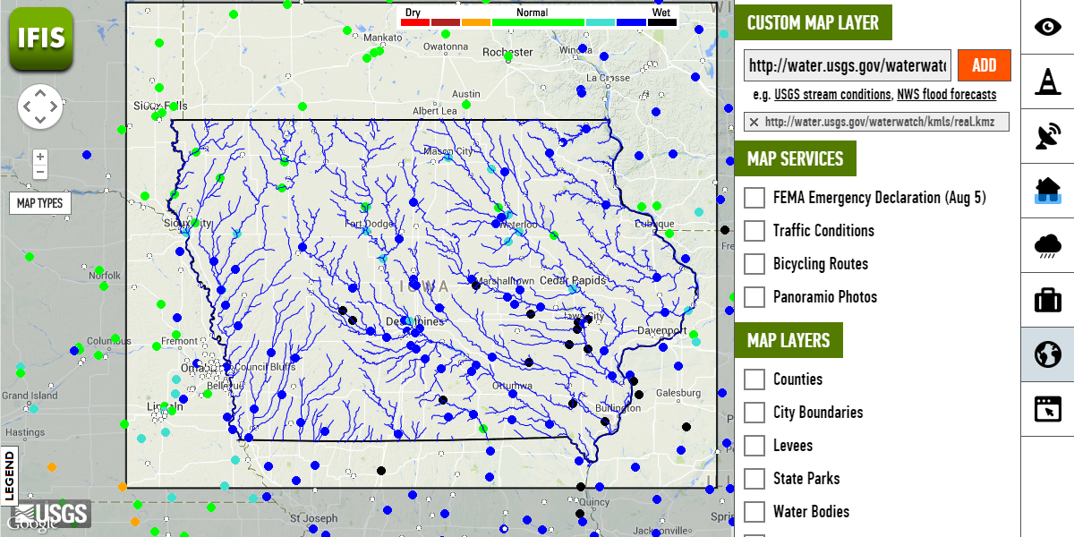
Add any map layer on IFIS using KML, KMZ or GeoRSS formats.
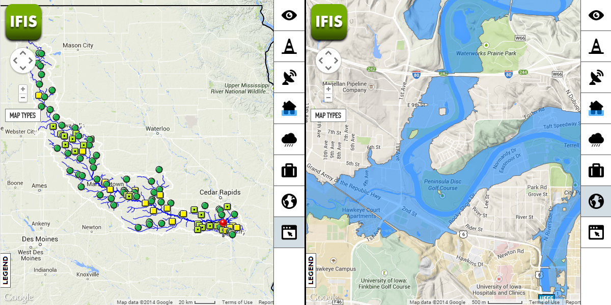
Split map view for IFIS to compare features and data resources for two location on the map.
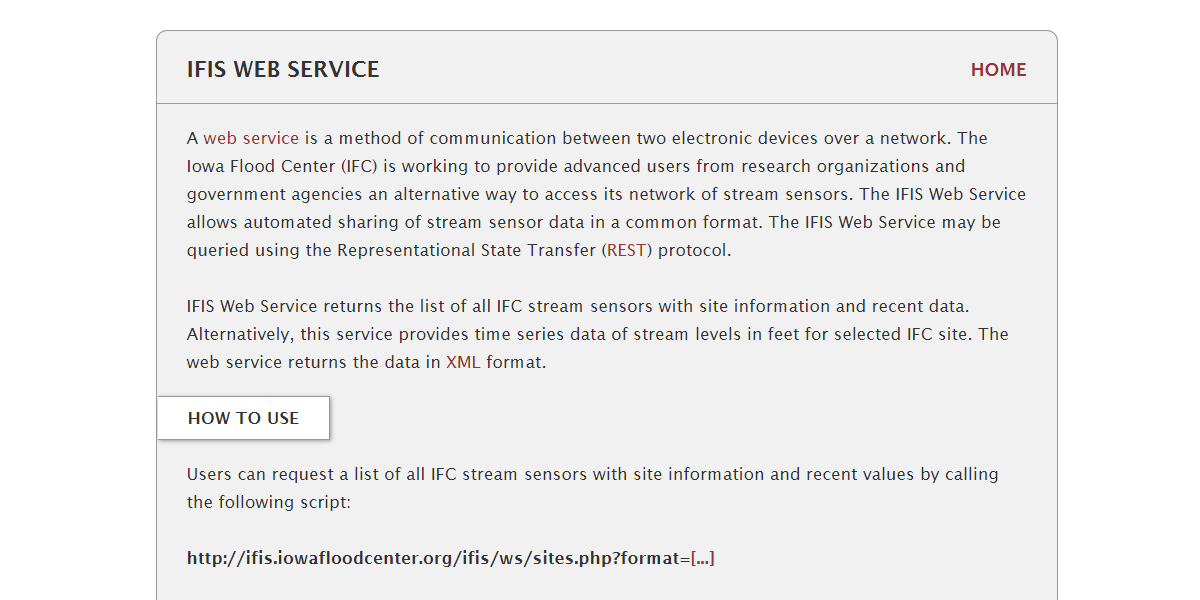
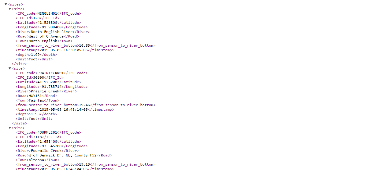
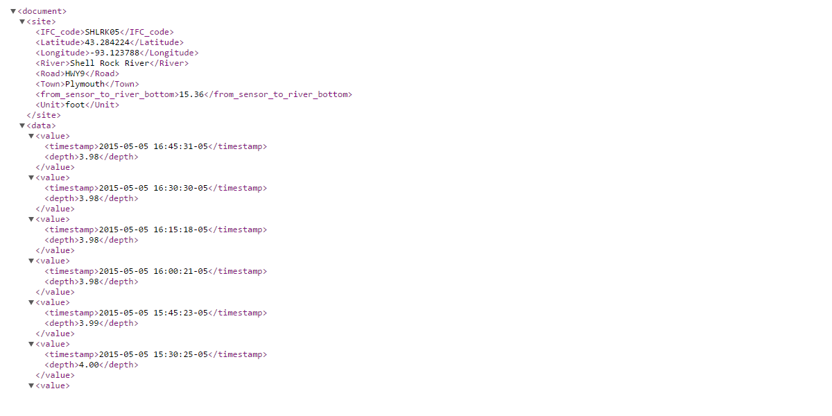
Integrate and download data from IFC stream sensors using IFIS Web Service